|
In stock
|
Out of stock
|
||
|
|
|||
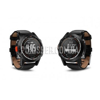
The model is equipped with a barometer, a compass, all sorts of timers and a vibration signal.
In addition, from the testimony of a monochrome LCD display,
you can find out the speed and altitude of the flight, time at once in 4-hour zones,
and if you download the flight plan from a special application in advance,
then the route and the distance to the nearest airport. The buttons on the case are responsible not only for quick access to these functions,
but also for the remote control of the Garmin Virb action camera.
A low-power screen allows the watch to operate on one charge for two days in GPS mode and for two weeks in normal mode.
An altimeter, an electronic compass, a barometer, several timers and vibration signals are built into this watch - with their help, you can track flight tasks.
Indicators of flight speed, current time of four belts, distance to the nearest airport (useful in case of an emergency landing)
and the route are displayed on the LCD screen of the clock. For the last two functions on their case there are two corresponding buttons.
The screen in this watch is monochrome. Its resolution is 70x70 pixels.
Thanks to this screen, the watch can work for two days in GPS mode, and in touch mode - for two weeks.
Using the Garmin Pilot app on a compatible Bluetooth enabled device, pilots can create flight plans and waypoints, and then load them into the D2 GPS watch.
Also, D2 allows you to remotely control the action camera Garmin VIRB.
D2 meet the stringent requirements of pilots from around the world, as they contain a worldwide aviation database.
With the help of hours, pilots will be able to easily access navigation functions, as well as to create waypoints for the current location.
In addition, pilots can download flight plans and create waypoints in the same way as they do,
using Garmin portable GPS navigators. The watch can also display the travel speed, GPS track, distance,
estimated flight time, azimuth, planning distance, and more. The altitude alert informs the pilot if he approaches or leaves the selected altitude.
The accuracy of navigation is ensured by the support of WAAS GPS,
the presence of a high-precision altimeter, a compass with a planned navigation device and a moving map.


